DRAWING ASSIGNMENT 3: MAPPING PRECEDENTS
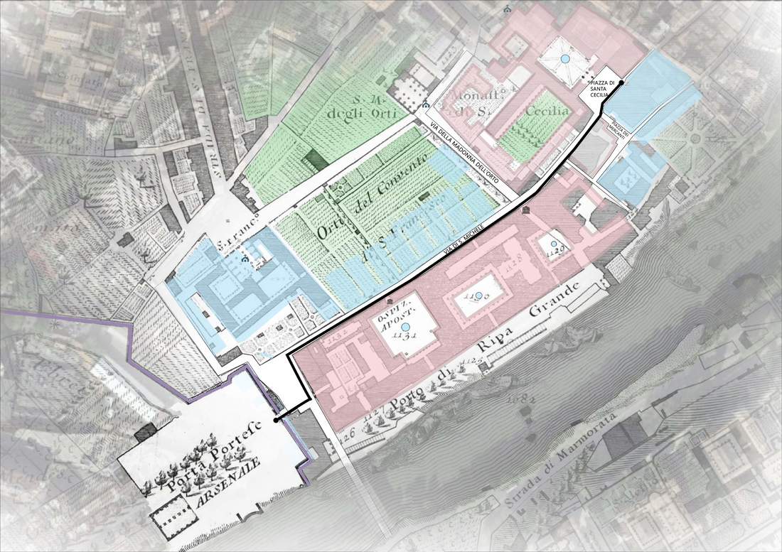
The objective of this drawing assignment was to map an assigned sequence between a certain piazza and Porta Portese—the site of our upcoming final project. My sequence was from Piazza di Santa Cecilia to the Porta Portese. After walking through the sequence, it became apparent that a majority of the important spaces were not within this sequence, but rather just off to the sides. The road is narrow and flanked by a very tall building with a monotonous facade on one side, and a tall blank wall on the other. Thus the space is not dynamic or given any character. But off the side streets from the main road, there are courtyards and piazzas with fountains, and even another church. In my mapping, I started by overlaying the modern day satellite imagery with a Nolli map from the 17th century. The red areas are buildings that have existed since the Renaissance time period, while the blue are newer additions. The green area is a space that used to be a garden before it was developed into housing. I denoted churches, fountains, and the Aurelian wall. I wanted to show how the space does not have importance in and of itself, but rather is interesting because of the areas that exist, have existed, and could potentially exist along its datum.
