DRAWING ASSIGNMENT 5: URBAN DESIGN PARTIS


This assignment was intended to get us thinking about the problems, and potential solutions, to the urban fabric in Rome. Using existing figure-ground maps of the Trastevere and Porta Portese area of Rome, we created new figure-ground maps that reorganized the grids, adding, removing and shifting connections to create a more efficient city.
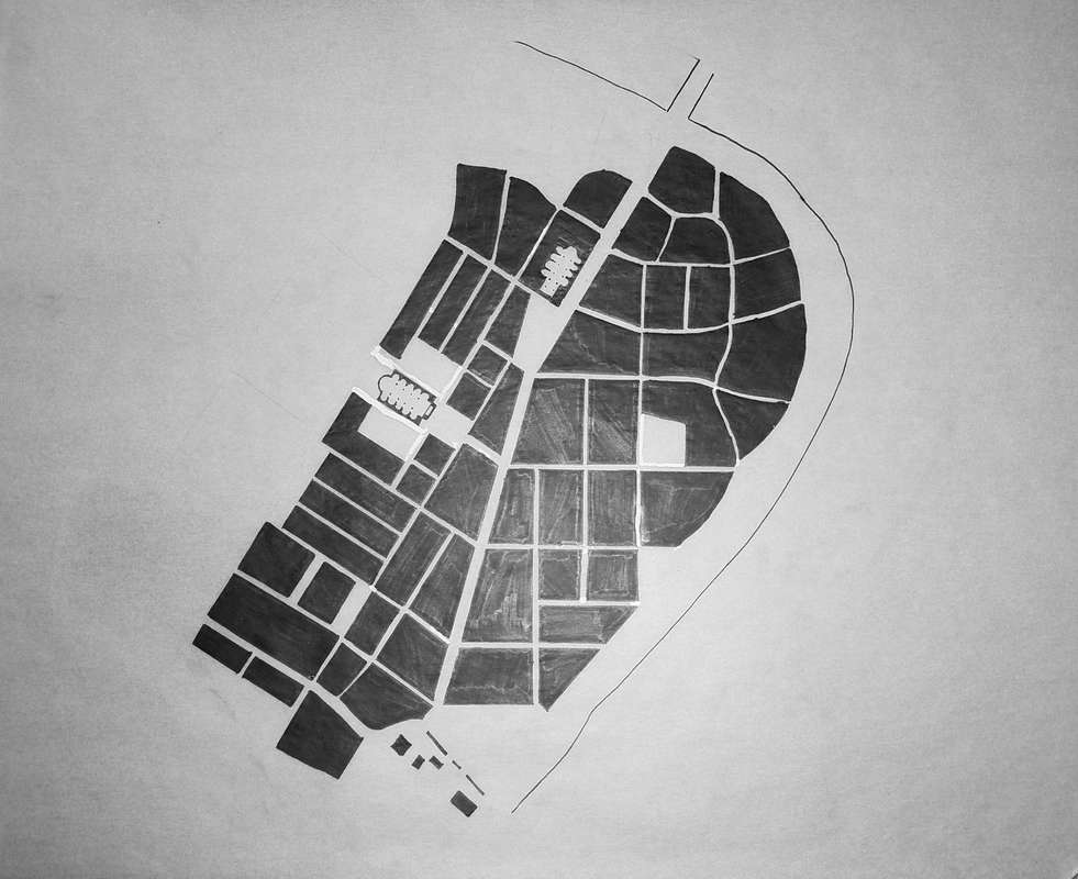
The first map I designed created a more direct connection from our site at Porta Portese to the Tiber Island north of it. The grid here consists of rather large city blocks, which serve to provide wider spaces for parks and greenspaces in their centers. There is also a very direct connection from the site to the existing Piazza Mastei. Currently, Piazza Mastei does not receive very much use and is always empty. Providing a more direct connection and opening it up to Viale Trastevere would allow more people to enjoy it.
The second figure-ground I did focused on a more radial circulation throughout the Trastevere area. The arrangement of building blocks and piazzas creates circular routes that move around Piazza Mastei, which serves as a hub on Viale Trastevere. The outermost ring crosses over Piazza Porta Portese, providing two routes back to the main road through Trastevere. There is also a direct east-west road from Piazza Mastei to a new bridge across the Tiber river to the Testaccio area.
The third map I have shown here is reordering the grid of Trastevere into more orthogonal blocks. The main road has been relocated from Viale Trastevere to a new road that connects the Porta Portese site directly to the Tiber Island to the North. Since the island is already a major gathering space, it makes sense to move traffic from there and guide people towards the site. I have also opened up the Piazza Mastei and places a church at the center of it, which acts as a monument in the center of the neighborhood where people can congregate.
