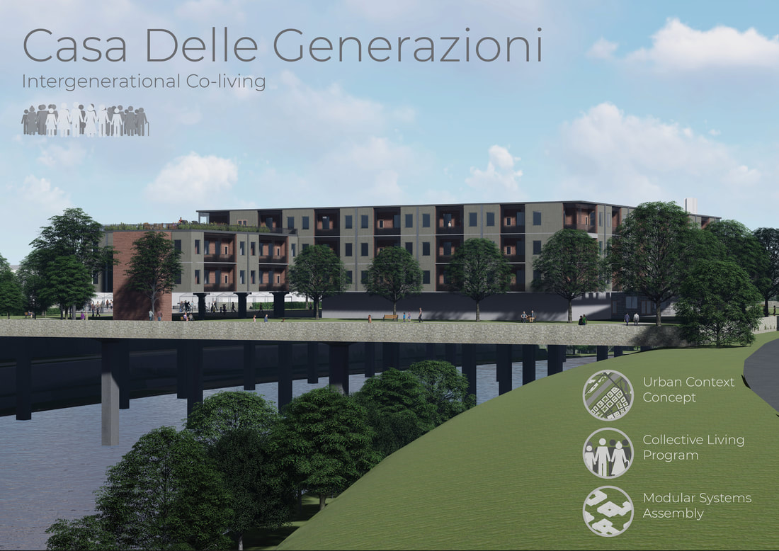
 I've had quite the busy holiday season. I took an elective class over the winter intersession about architectural competitions. We did some research on the history of architectural competitions before taking on a competition of our own. My group decided to take on Bee Breeder's Rome Collective Living Challenge. Rome has had years of unemployment, raises in rent, housing shortages, and now many are homeless. Similar to many urban centers, it is becoming unaffordable. Our group's mission was to design a concept for affordable co-living in Rome, to not only provide more housing, but foster community interactions among the inhabitants. Our flexible design takes advantage of the unused space over the Tiber River that cuts through Rome. Large columns support what is a essentially a large bridge connecting the neighborhoods on either side of the river. The first level is completely devoted to small retail and restaurant spaces on the "street" that is created between the building's mass. The rest of the bridge is a park with several acres of walking paths, trees, and areas for children to play. The site we chose as an example has an empty lot next to the river which has been repurposed into a piazza for socializing and holding markets.
On the upper floors there are standard 2, 3 and 4 bedroom units, however a large portion of the programmed space is meant to be communal spaces, such as workspaces, libraries, gyms, lounges, daycares, and even rooftop gardens. The spaces are large, adaptable to the needs of those inhabiting these buildings, and spaced throughout so there is a communal space near every person's home. The building itself is comprised of seven different "modules" that house varying amounts of people and contain different sized communal spaces. These modules make it easy to apply this solution to any location along the Tiber River based on size and existing land features. Click here to see all the final boards for our project!
0 Comments
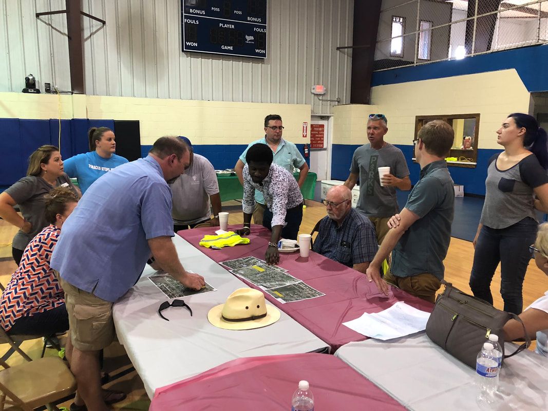
IQC visited Altus back in August, and since then we have compiled a booklet of our proposed changes for the city. The main ideas are:
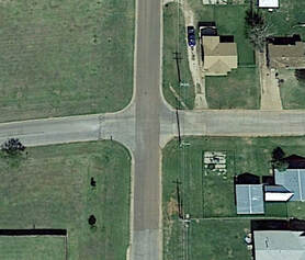
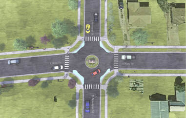
The most ambitious recommendation is for the intersection at Katy Drive and Navajoe Street. The improvements here involved many of the basic walkability safety features for all the roads we toured. The town should create 6 foot wide sidewalks around the entire area and turn the intersection at Katy Drive and Navajoe Street into a mini-roundabout. The existing intersection is about 48 feet across, which allows room for a mini-roundabout without having to pour new asphalt or alter the street beyond painting it. There is space for a 15 foot street around an 18 foot diameter center island. Curb extensions painted on the corners and crosswalks added on all sides improve crossing safety. All of these sidewalks should include street lighting and amenities such as benches and trash bins.
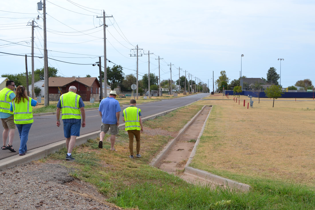
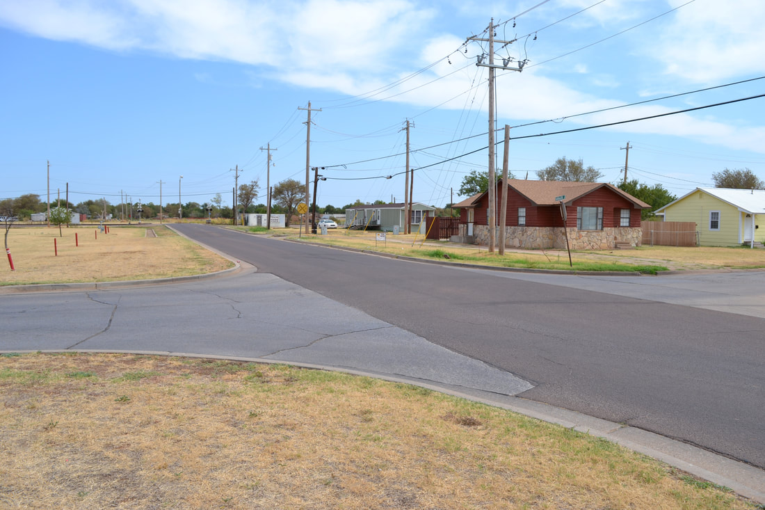
Our plans to improve the railroad crossing involve many of the tactics to improve overall walkability safety. Currently the crossing has no sidewalks, no railroad crossing arm or signage, and the road is very curved with a high speed limit for the area.
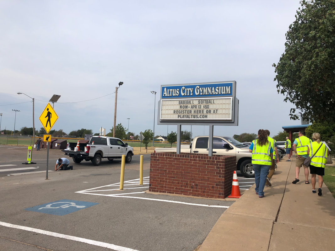
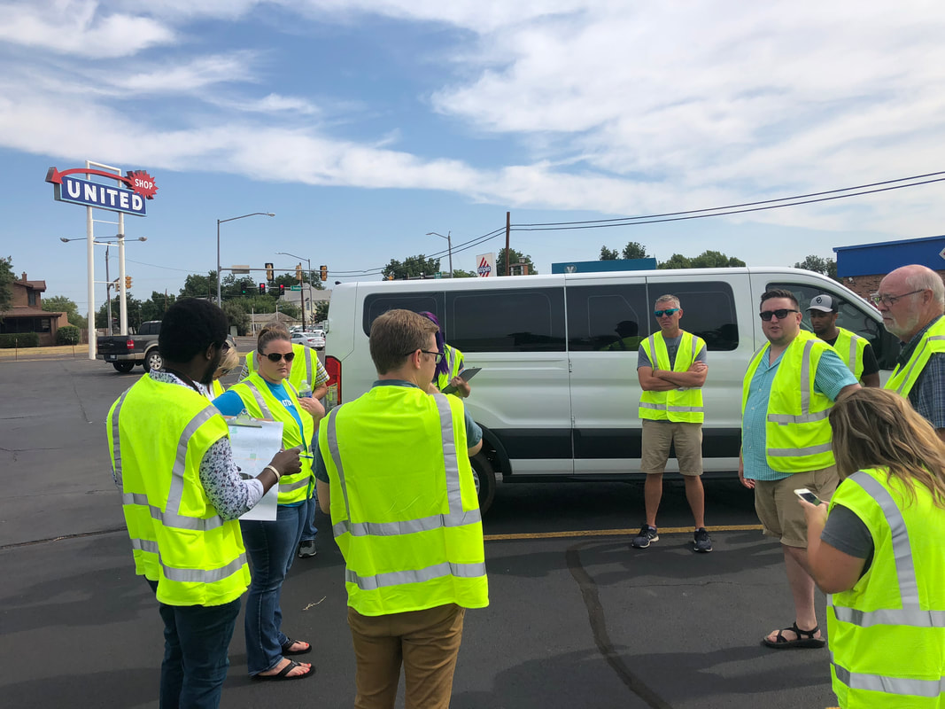
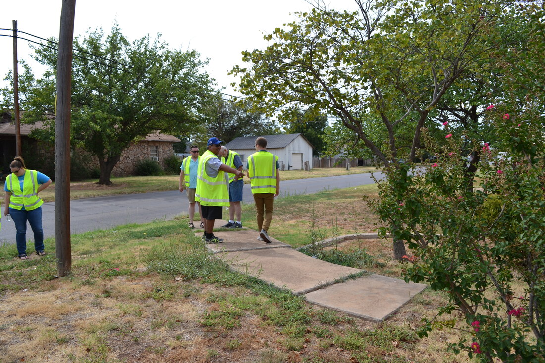
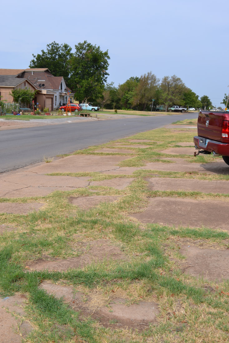
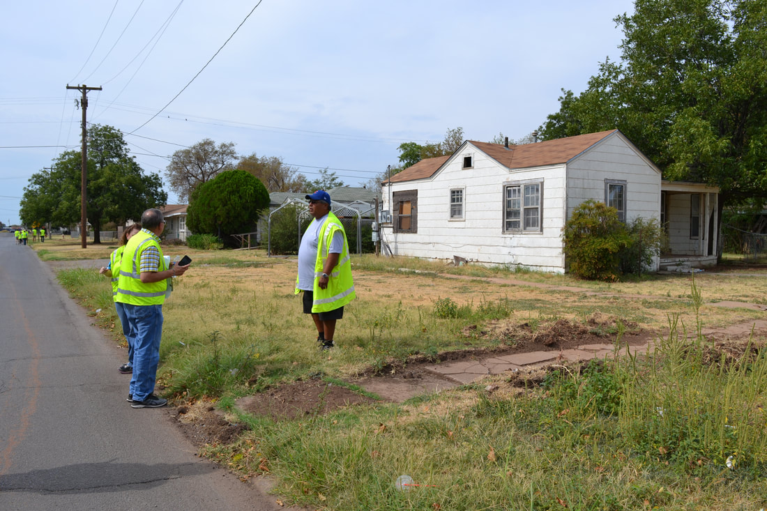
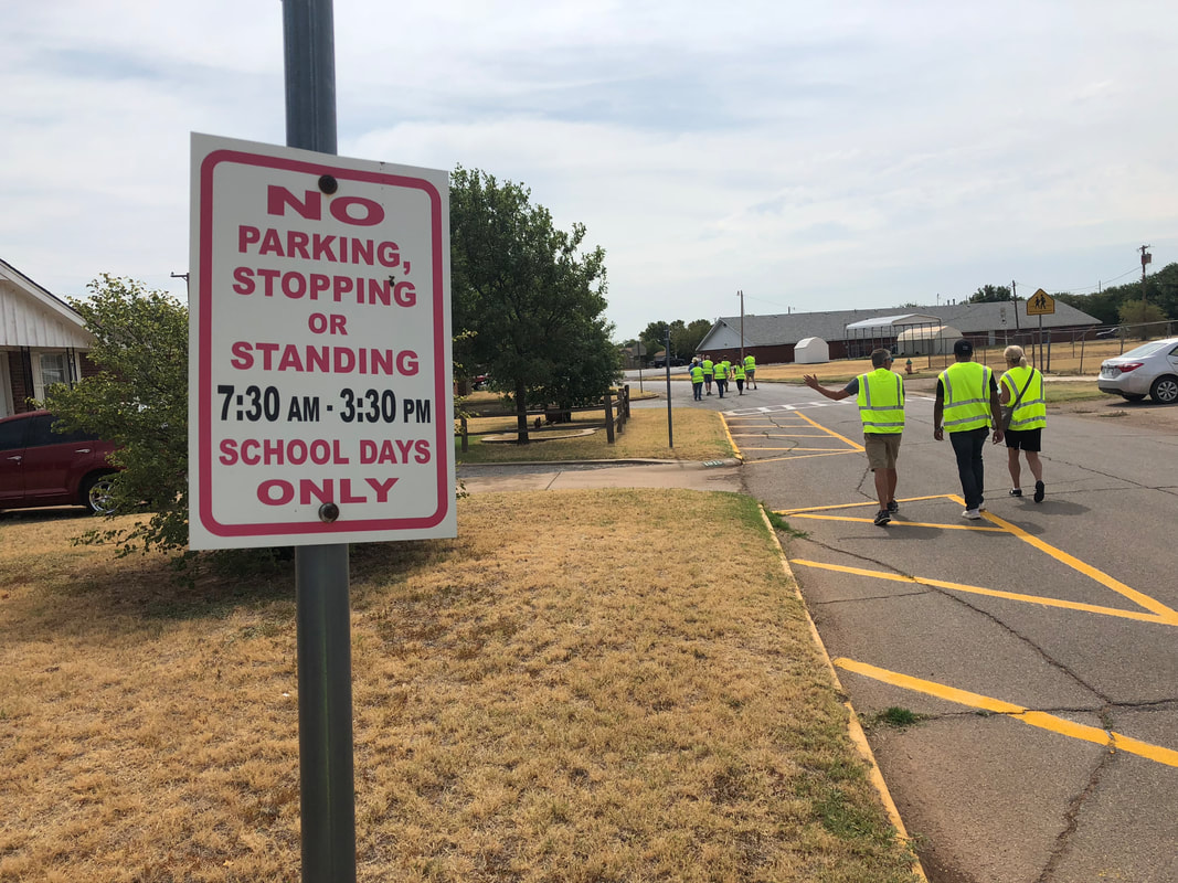
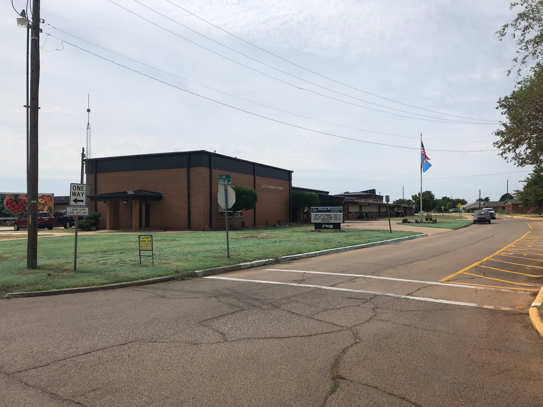
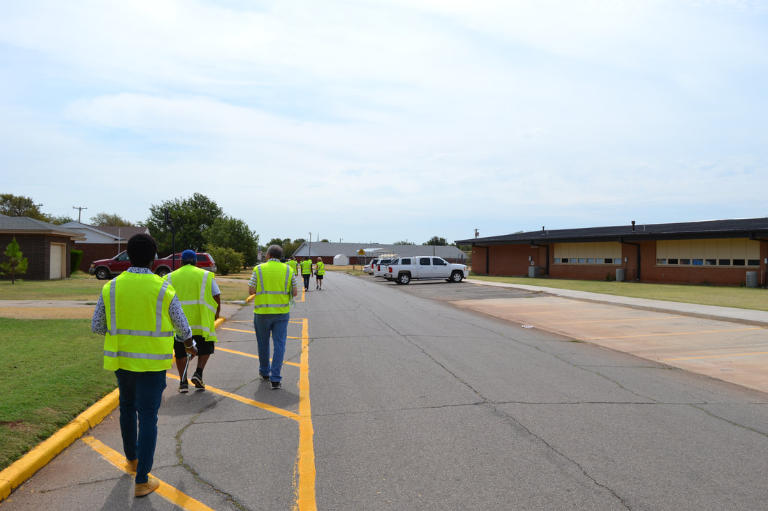
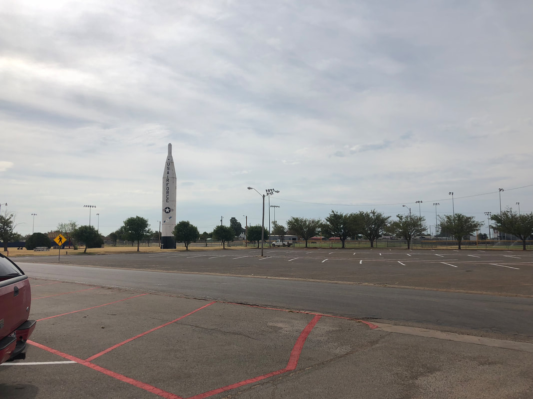
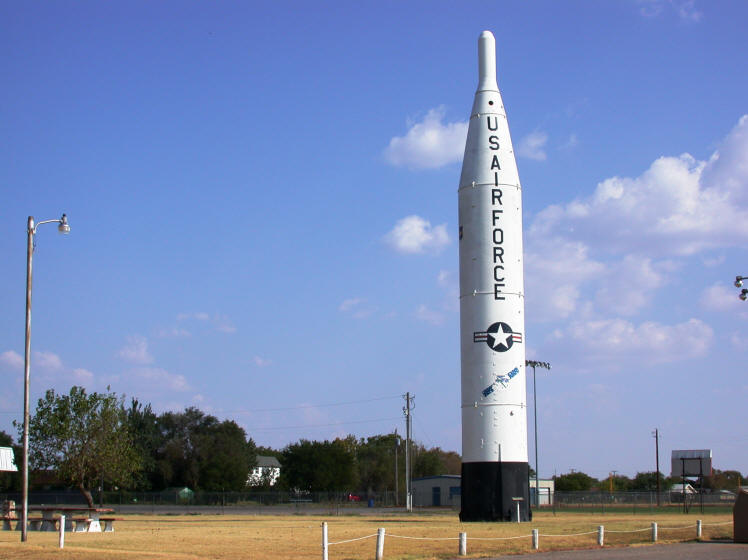 Cole Heights Park aka "Missile Park" Source: siloworld.net This past Thursday IQC visited Altus, Oklahoma, a town of about 19,000 people and hour west of Lawton. We did a walkthrough circle of the roads from the Parks and Recreation Department by Missile Park, past Altus Primary School, down Inis Street, west along E. County Road 165, and back up Navajoe Street to the Parks and Rec building. Afterwards we had a meeting to discuss our findings. Right off the bat we noticed a couple of consistent issues. There was a severe lack of sidewalks down the major North/South road Navajoe Street. Asalee Street, the road that leads from Navajoe to the elementary school, also had a lack of sidewalks, or poorly maintained sidewalks. We recommend that the city prioritize the addition and maintenance of sidewalks along these primary walking routes for children to safely walk to school, and citizens to be able to walk to the downtown area. We noticed that at the railroad tracks there was a lack of crossing arm or signage, which seems unsafe. Another safety issue was that there were no streetlights. This poses a hazard for people walking at dawn or dusk, especially in the winter months where the sun sets early. The last safety problem we noticed was a few of the intersections along Navajoe Street lacked stop signs or other signage, and the speed limit along the street seemed a little high for a residential street. Lowering this limit and altering intersections with stop signs would improve vehicular safety.
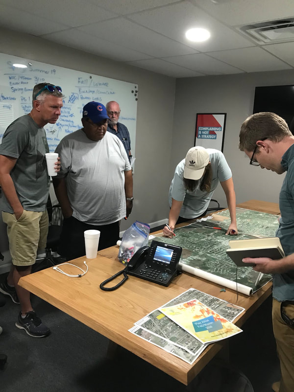
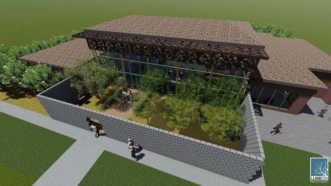
Other non-safety related observations were that Missile Park seems like an under-appreciated asset to the town. Altus had recently opened a splash pad near the park that is free for people to use. Placing better signage at the surrounding roads and wayfinding signs would increase usage of this park and promote walking in the area south of the railroad tracks. I look forward to working with IQC on our formal proposal for the City of Altus.  Exterior rendering from east side entrance. By Amy Hostetter. After our visit to Comanche, Oklahoma, back in April, the IQC team got to work designing a new community center concept for the town. These are the graphics depicting our final design. The site of the previous Woodrow Wilson building is on a huge empty lot of which the city of Comanche has obtained a majority. We developed a site plan for the entire lot for the future development of Comanche's main civic center. In addition to the community center, Comanche would like to build a new city hall, a police station, and a fire station. The potential fire station, which would have 8 to 10 bays, is located at the corner of two streets, right next to a major highway to quickly respond to many areas within the county. The city hall is located overlooking the highway. There is a steep drop off right before the highway, so the city hall would have an excellent view looking east. The community center is located to the west on the remains of the Woodrow Wilson building. A roundabout to the north would connect the community center and city hall, providing some additional parking and a drop-off area. In between all of the buildings is a park. There is a linear path that creates a physical and visual connection between the two main buildings. Although not included on the plan, there is space for a police station to be constructed next to the city hall. Final Plans |

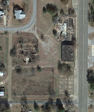 Satellite view of existing site. | 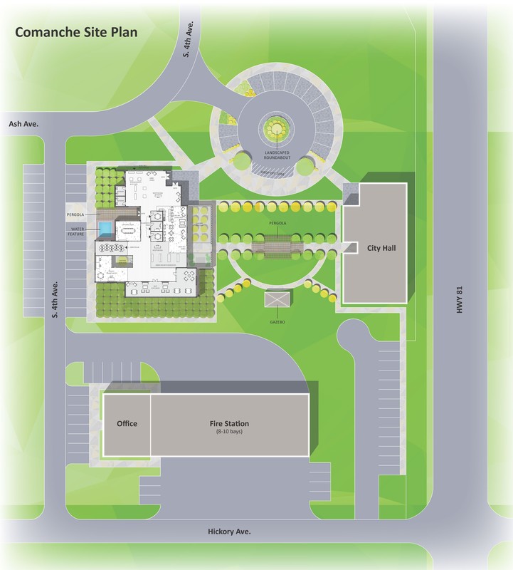 Final site plan. Created by Rachel Ware. |
Final floor plan. By Amy Hostetter.
The community center will have several areas. The plan shows green areas that are landscaped or are courtyards. There are different materials to denote different spaces, for example the café space to the right is separated from the library area by a material threshold. As one moves through the building towards the back (the south side) the spaces are meant to promote quieter activities. The front with the museum and café would be the loudest. The main spaces in the program are a lobby that includes museum displays, a café, a library, a conference room, some small collaborative spaces, a computer lab, a creative-making workspace, and a study room.
Isometric diagram. Rendered by Amy Hostetter.
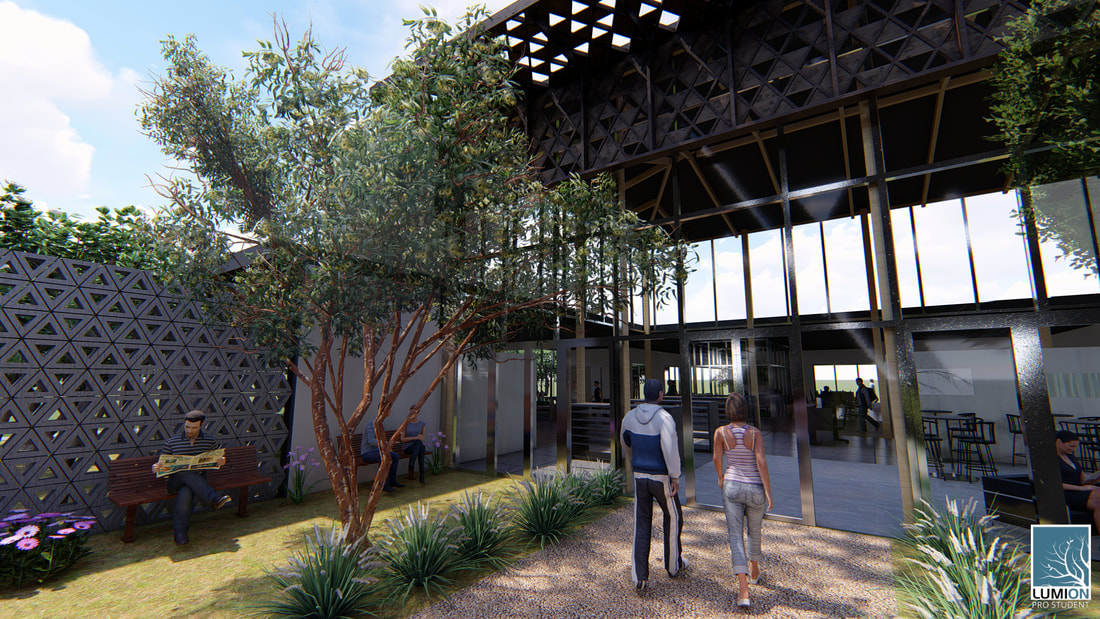
A landscaped roundabout to your left, a mural depicting the history of Comanche on the brick wall to your right (1). You walk down the sidewalk towards the northeast corner of the new community center. It is a Sunday, so the concrete plaza beside the building has a few vendors with tents set up—farmers selling some of the freshest produce around, and a couple of women selling homemade crafts and jams. The brick walls evoke a sense of the traditional materials, while tall glass windows with aluminum frames add a modern touch. You continue along the east side of the building. Uniquely shaped triangular blocks made of concrete are stacked high. The holes in the center of each block form a semi-permeable wall. You can see through them, but only partially.
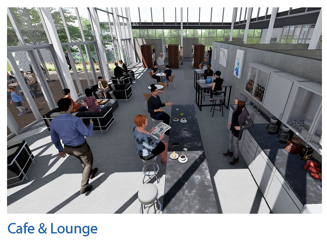
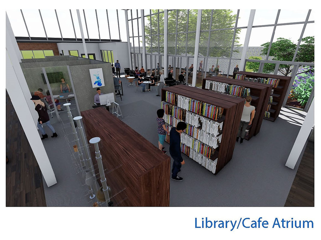
An opening in the wall is the main entrance into the building (2). It forms an axis through the beautifully landscaped park to the entrance of the city hall. You turn right and stroll through a fairly spacious courtyard. Rows of trees create an excellent shaded space for people to enjoy the fresh air while still feeling secure. Then you open the double doors and are greeted by a grand atrium. It is two stories high and lined with windows, letting in ample amounts of natural light into the café below (3). The café, while not huge, is enough space for someone to grab a cup of coffee and enjoy some company in the comfortable seating.
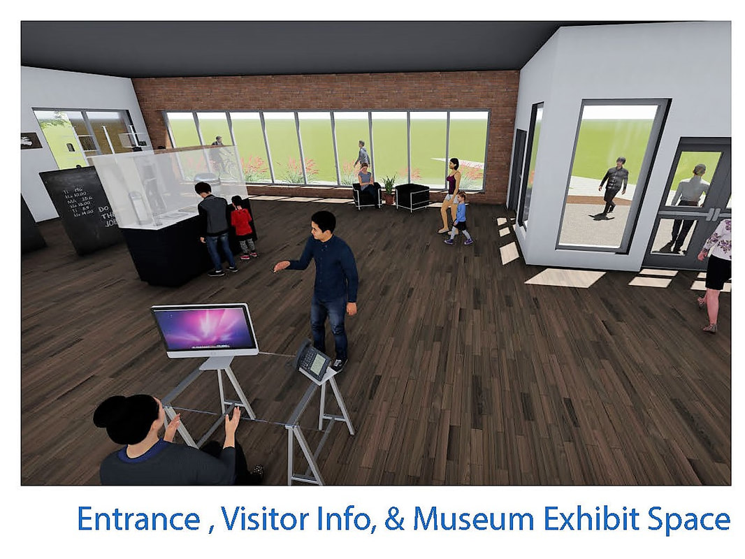
You walk through the café to an alternate entrance. Most people who park at the roundabout would use this entrance. Immediately, an information desk is at the front to answer any questions. Near the entrance is a small lounge space for guests (4). You move beyond the small lounge area and meander through a series of display cases that showcase old photographs and objects from Comanche’s history (5). This mini-museum is very flexible and the displays can be changed or updated as the city pleases.
You proceed past the museum into a wide corridor. The right side of the corridor has an additional entrance that is surrounded by beautiful plants and a small pond beside it. To the left side of the corridor are three collaboration spaces (6). They are fairly open to the surrounding space, with only 8 foot tall glass panels separating them from the corridor, and solid walls on the opposite side separating them from the café. You go inside one of them and feel a sense of privacy while still being connected to the rest of the building. With a table and a few chairs, they encourage small groups of students to work and study together.
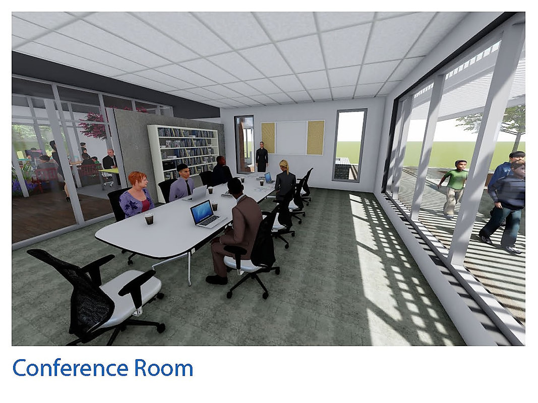
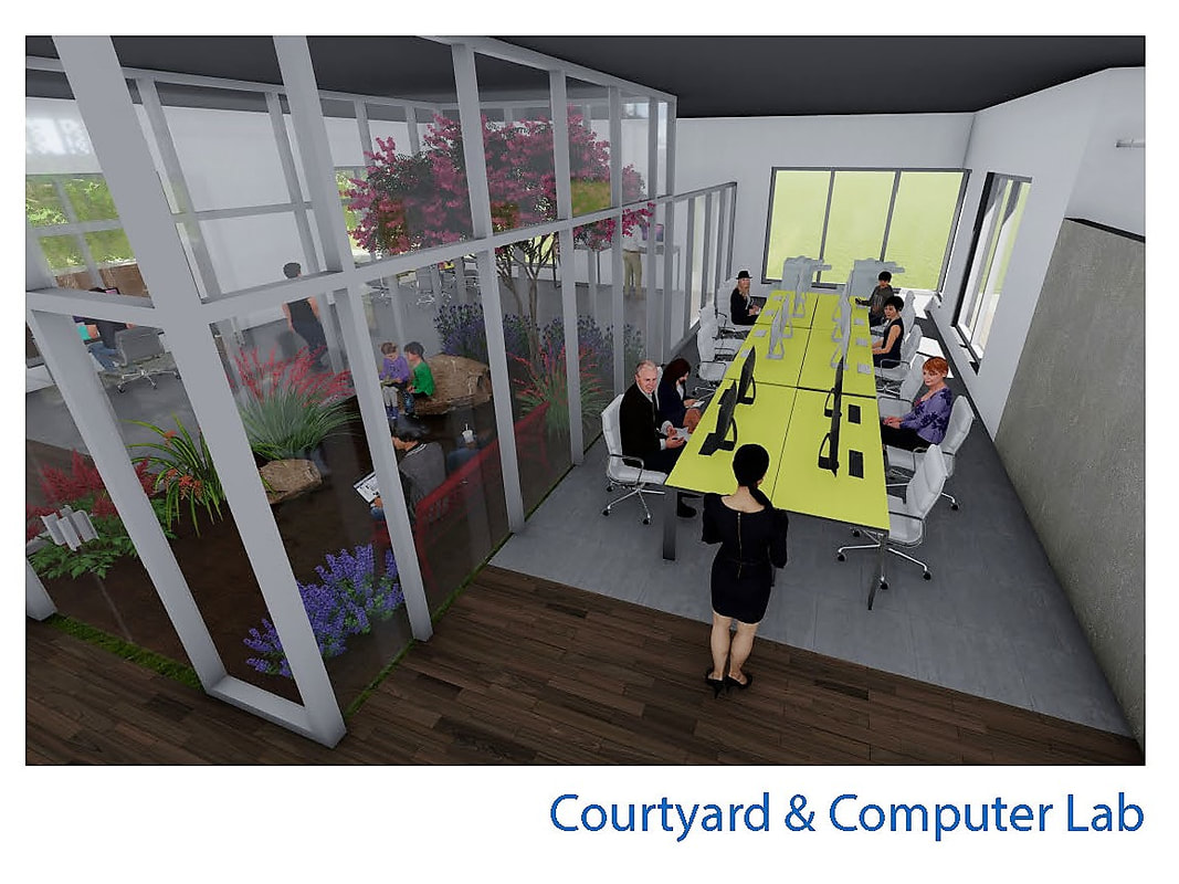
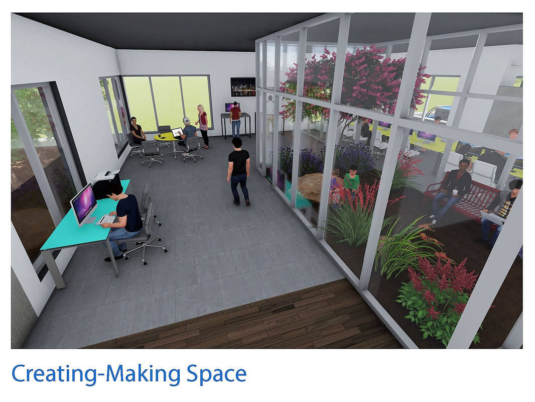
Walking farther down the corridor, you look to your right. A glass enclosed conference room provides the same sense of semi-privacy as the collaborative spaces (7). A slightly larger table and a projector allow presentations or meetings to be held there. Ahead, you see a courtyard within the building, filled with native flora and providing a pocket of nature for people to enjoy (8). Two spaces are adjacent with a view of the courtyard, each of which are separated by a frosted glass barrier. There is a computer lab, with several computers available for the community to do research or stay in touch with their loved ones (9). Additionally, there is a creating-making space, filled with desks and an opportunity to work on creative projects such as drawing, making posters, or any other hobby that requires a bit of extra table space (10).
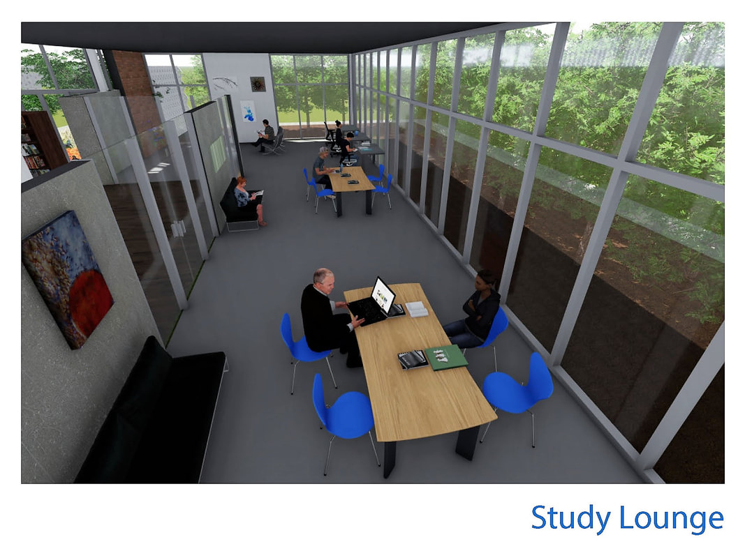
Across from the courtyard opens up to the library (11). You are now in the quieter portion of the building. You move towards a section of the space that contains several chest height rows of books. Some of them are historical volumes, pertaining to history of Comanche and Oklahoma. Others are modern fiction and nonfiction for the community to enjoy. The space is still open to the rest of the building and everything feels connected and modern. To your right on the south side of the building is an enclosed study area (12). Inside, the south-facing windows allow a lot of natural sunlight. It still has frosted glass panels somewhat separating it from the rest of the building, while allowing students a quiet and isolated place to study. Exiting the study room brings you full circle to the café again, back to the more lively part of the building meant for socializing. Overall, it is an extremely accessible building meant to have an open floor plan and promote a united community.
An opening in the wall is the main entrance into the building (2). It forms an axis through the beautifully landscaped park to the entrance of the city hall. You turn right and stroll through a fairly spacious courtyard. Rows of trees create an excellent shaded space for people to enjoy the fresh air while still feeling secure. Then you open the double doors and are greeted by a grand atrium. It is two stories high and lined with windows, letting in ample amounts of natural light into the café below (3). The café, while not huge, is enough space for someone to grab a cup of coffee and enjoy some company in the comfortable seating.
You walk through the café to an alternate entrance. Most people who park at the roundabout would use this entrance. Immediately, an information desk is at the front to answer any questions. Near the entrance is a small lounge space for guests (4). You move beyond the small lounge area and meander through a series of display cases that showcase old photographs and objects from Comanche’s history (5). This mini-museum is very flexible and the displays can be changed or updated as the city pleases.
You proceed past the museum into a wide corridor. The right side of the corridor has an additional entrance that is surrounded by beautiful plants and a small pond beside it. To the left side of the corridor are three collaboration spaces (6). They are fairly open to the surrounding space, with only 8 foot tall glass panels separating them from the corridor, and solid walls on the opposite side separating them from the café. You go inside one of them and feel a sense of privacy while still being connected to the rest of the building. With a table and a few chairs, they encourage small groups of students to work and study together.
Walking farther down the corridor, you look to your right. A glass enclosed conference room provides the same sense of semi-privacy as the collaborative spaces (7). A slightly larger table and a projector allow presentations or meetings to be held there. Ahead, you see a courtyard within the building, filled with native flora and providing a pocket of nature for people to enjoy (8). Two spaces are adjacent with a view of the courtyard, each of which are separated by a frosted glass barrier. There is a computer lab, with several computers available for the community to do research or stay in touch with their loved ones (9). Additionally, there is a creating-making space, filled with desks and an opportunity to work on creative projects such as drawing, making posters, or any other hobby that requires a bit of extra table space (10).
Across from the courtyard opens up to the library (11). You are now in the quieter portion of the building. You move towards a section of the space that contains several chest height rows of books. Some of them are historical volumes, pertaining to history of Comanche and Oklahoma. Others are modern fiction and nonfiction for the community to enjoy. The space is still open to the rest of the building and everything feels connected and modern. To your right on the south side of the building is an enclosed study area (12). Inside, the south-facing windows allow a lot of natural sunlight. It still has frosted glass panels somewhat separating it from the rest of the building, while allowing students a quiet and isolated place to study. Exiting the study room brings you full circle to the café again, back to the more lively part of the building meant for socializing. Overall, it is an extremely accessible building meant to have an open floor plan and promote a united community.
Rendered Images
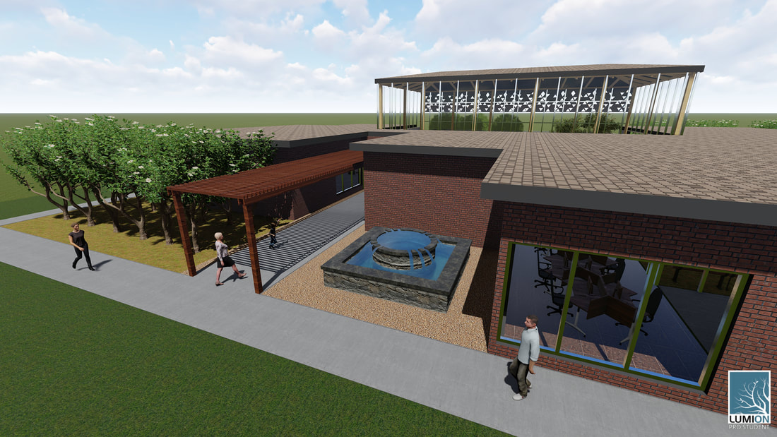
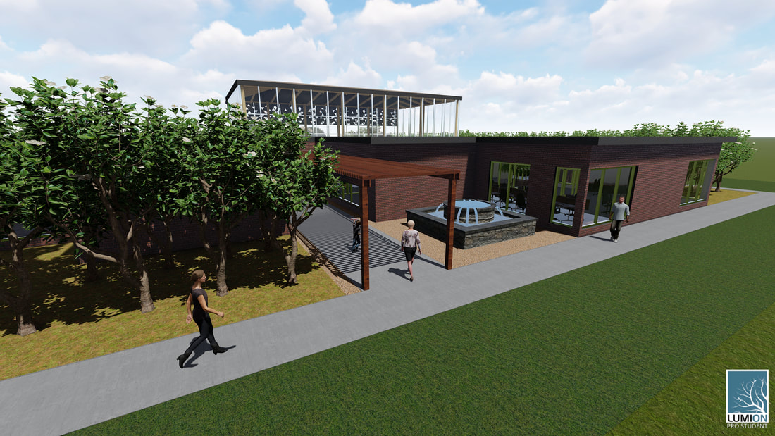
Exterior renders based on a 3-D computer model by Amy Hostetter, Rendered by Amy Hostetter.
Interior renders based on a 3-D computer model by Amy Hostetter, rendered by Rachel Ware.
The Project
| In my previous post I outlined the beginning steps of my first "real-world" project that wasn't related to school. While it took significantly more time than planned (thanks to my laptop permanently dying on me and having to juggle time with my primary job), I got it done. It feels good to have done it 100% on my own with only the aide of my partner and to have successfully navigated the world of architectural drawings. We measured the outside of the building from top to bottom, and every single room inside of it, then made it in digital form. | 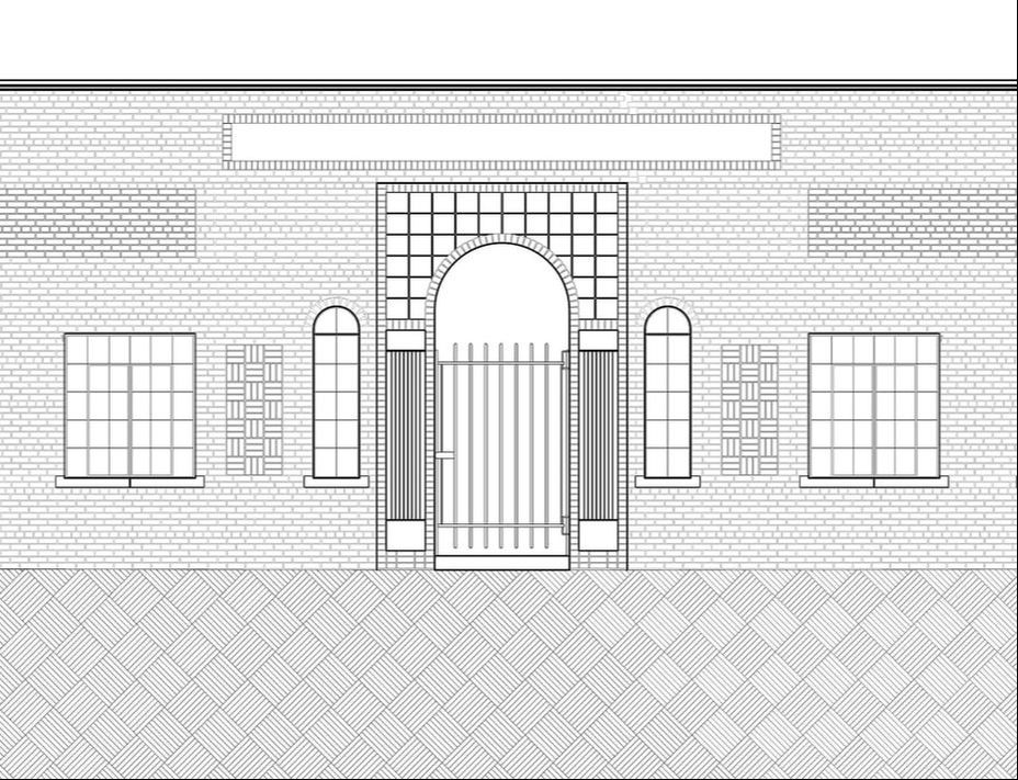 Sneak peek of the North elevation (see below as it's extremely wide) |
Final Drawings

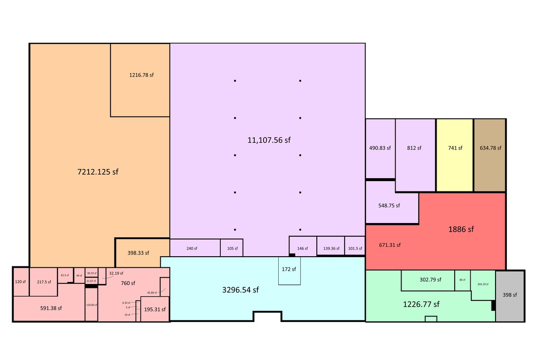
Final floor plan with square footages and key based on the main areas of the building
Final north front elevation (click to zoom because it is quite large)
Overall I learned quite a bit about time management, accuracy in the real world, and a familiarity with how to produce final drawings. It is more than just drawing lines in a computer. You need to make sure that everything lines up between the views. You need to have precise dimensions for repetitive components, otherwise being 1/4" off adds up to half a foot after the element has been copied a bunch. You need to alter the line weights based on the scale of the final product to ensure readability and provide a hierarchy. You need to have a complete spatial understanding of the building to accurately draw the interior, otherwise the spaces might not relate to each other correctly. I also realized the importance of taking plenty of pictures to document the real life project, as inevitably you will forget to measure a detail and need to reference it later (or have an incredibly organic portion that is impossible to measure that you will need to trace). But most of all you need patience, because it can get very dull staring at a computer and drawing for hours on end with no break. I do not regret taking part in this project, but it will be nice to go back to a more design oriented task now to get back to creativity and problem solving.
Bringing the Dead Back to Life
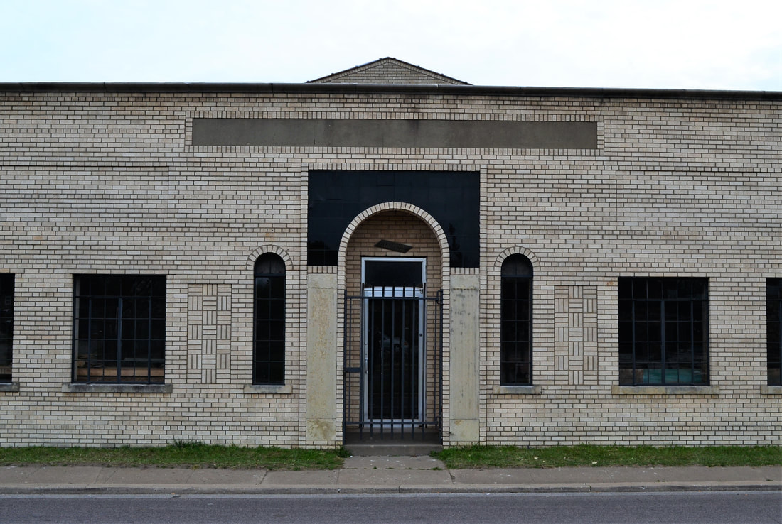
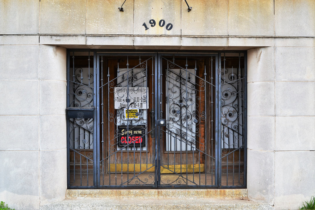
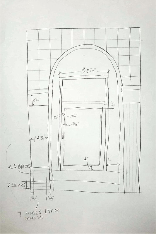
The front entrance.
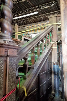
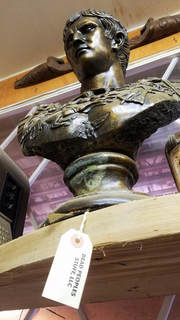
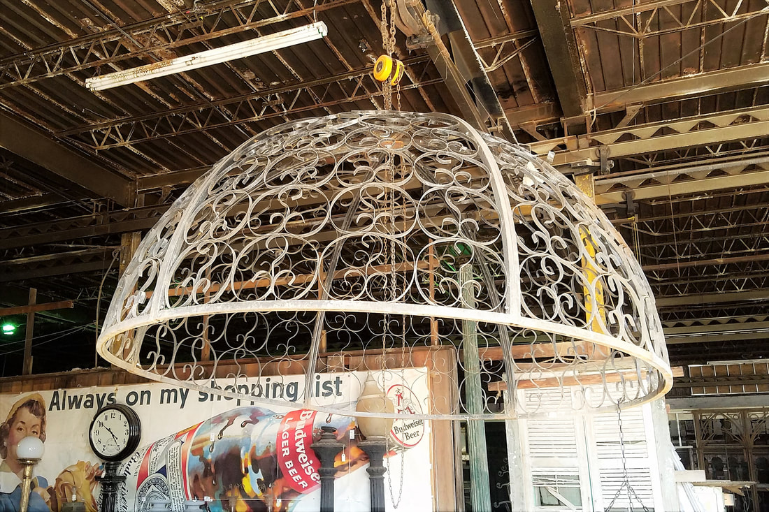
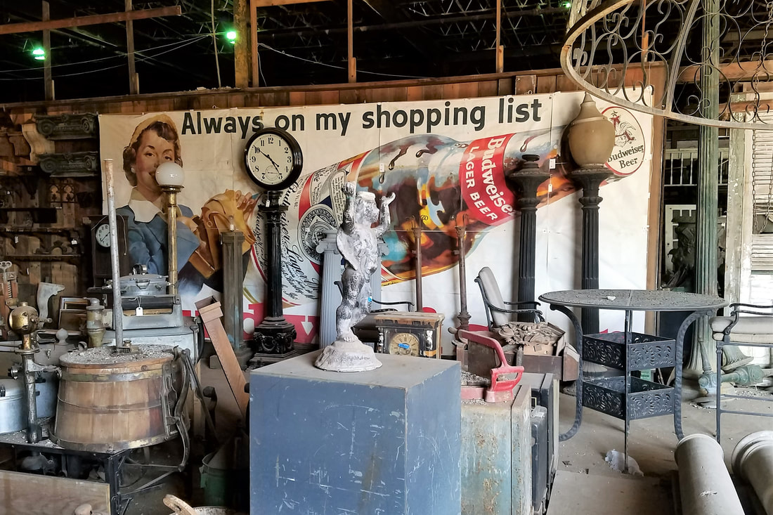
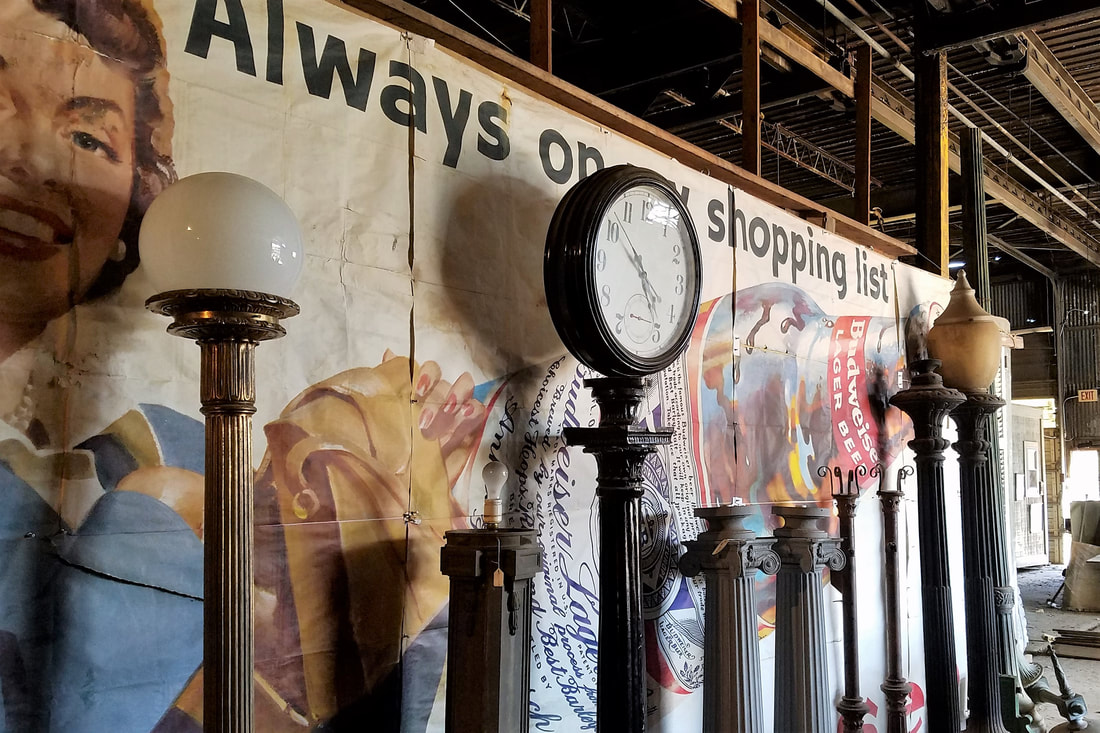
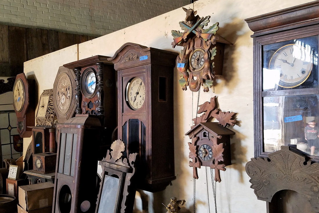
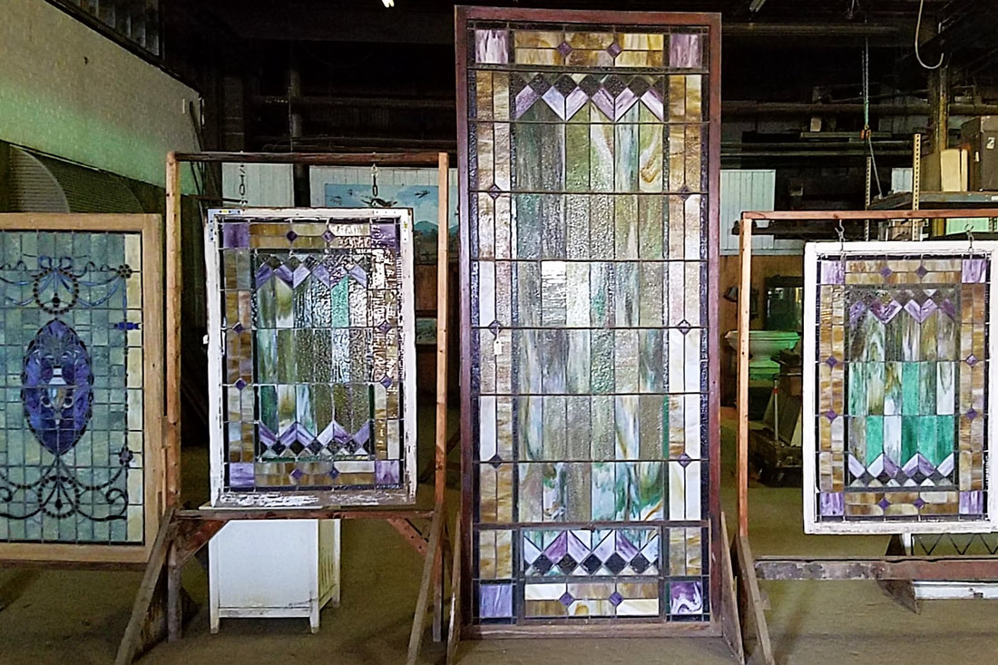
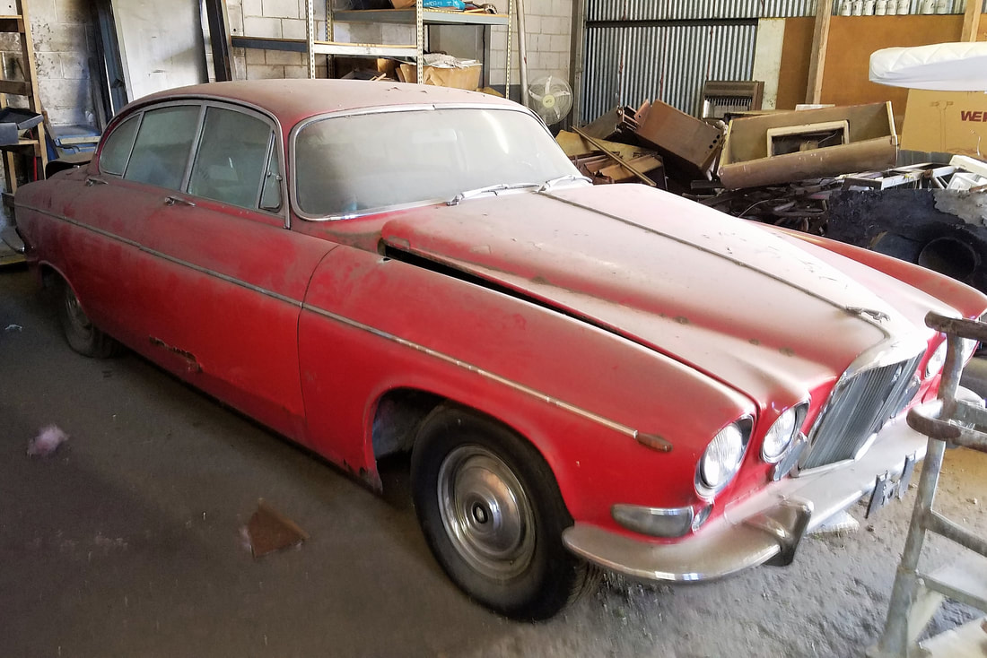
A few weeks ago, the dean of the OU Christopher Gibbs College of Architecture contacted me about a project for an acquaintance of his. His friend, an avid historic building and vintage car enthusiast, had recently purchased a building on Linwood Boulevard near Stockyards City in Oklahoma City. The plan is to renovate it and restore it to reflect its original appearance when it was built in the 1940s. The building has quite the eclectic history. Originally it was a transmission shop. Today it is an industrial warehouse that houses the businesses Architectural Antiques and a humorously titled business, Dead People's Stuff. Inside there are hundreds of antique parts that were salvaged from old buildings, such as windows, doors, wood siding, tiles, light fixtures and even an entire staircase. There are also smaller antiques such as clocks, statues, vases, and butter churners.
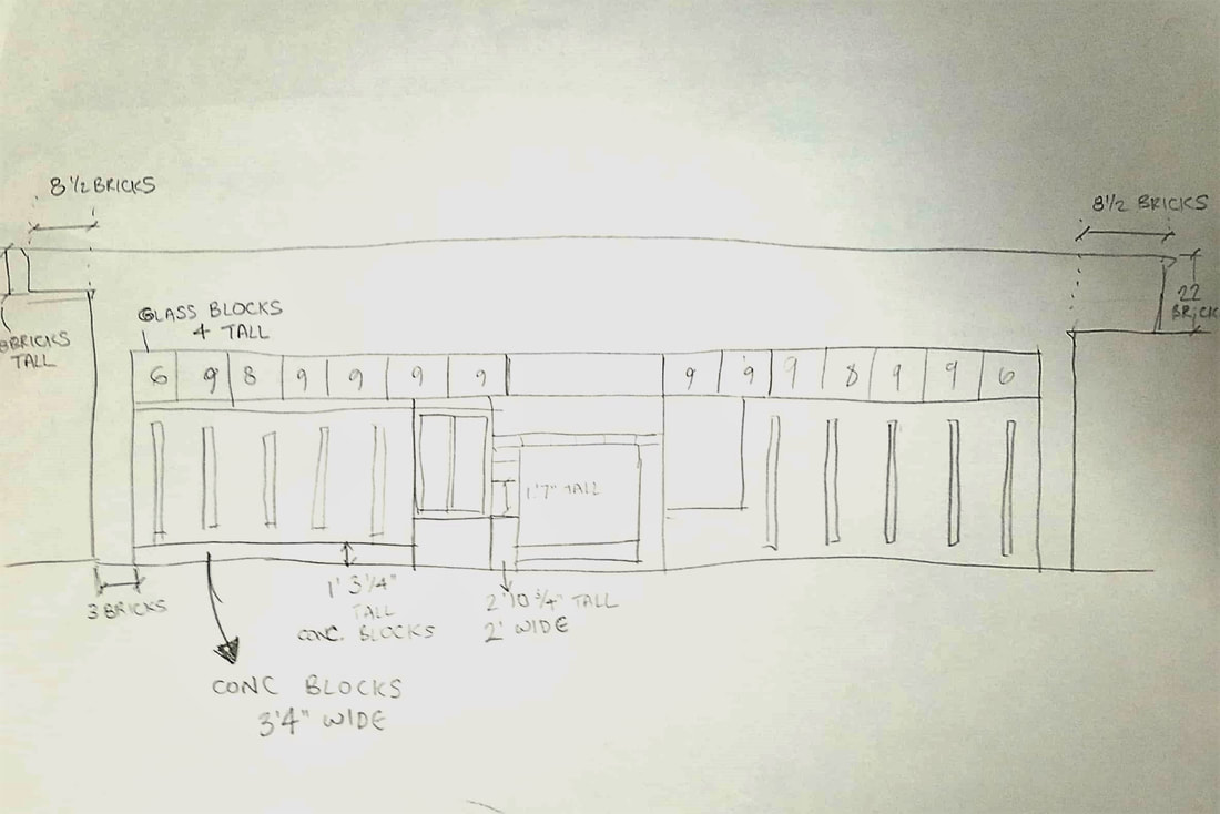
 | The building is not in very good condition. The roof is full of holes that leak whenever it rains. There is so much water damage to all of the antiques. Walls are cracked and crumbling, old wood is rotting, and a few of the windows are broken. There is progress however. As of the end of this last week, the windows on the west and north side have been replaced and the roof is mostly fixed. Construction workers are chipping out the glass block on the north side and tearing down the wood on the sides, to be replaced likely with storefront type windows to allow more natural light inside. Work on the roof is continuing and soon enough the contents within will once again be safe from water damage. Here are some of the pictures I have taken of the exterior and interior as I have worked on site. |
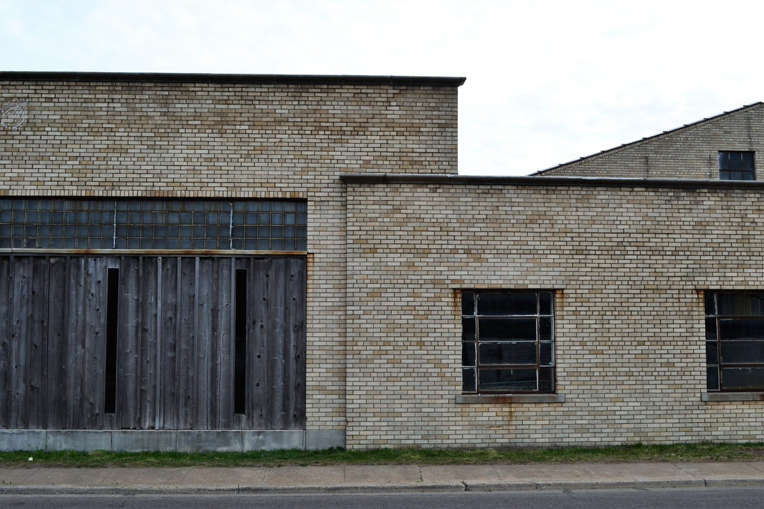
The client has asked that a student produce elevation drawings of the facade of the building, as well as documenting the square footage of all the warehouse and suite spaces. This involves measuring every detail of the faces of the building, hastily sketching it down, and later translating that into beautiful AutoCAD drawings. A fellow student, Nick Pazdernik, and I were chosen for the job. One of the biggest challenges for me is staying focused on that tasks at hand. When I am standing back looking at the bigger picture, it is easy for me to see a dozen different elements that need to be measured and jumping around between them. That window height, this concrete panel, that sill height, this wall span, that door trim. If it were my job alone, I might take 4 hours to measure one side of the building because I would be running back and forth instead of working methodically. Luckily, working as a team balances out my weaknesses with another's strengths and keeps us focused.
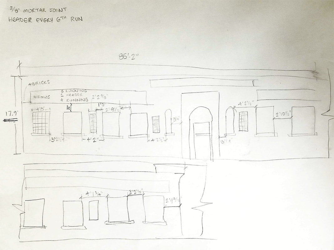 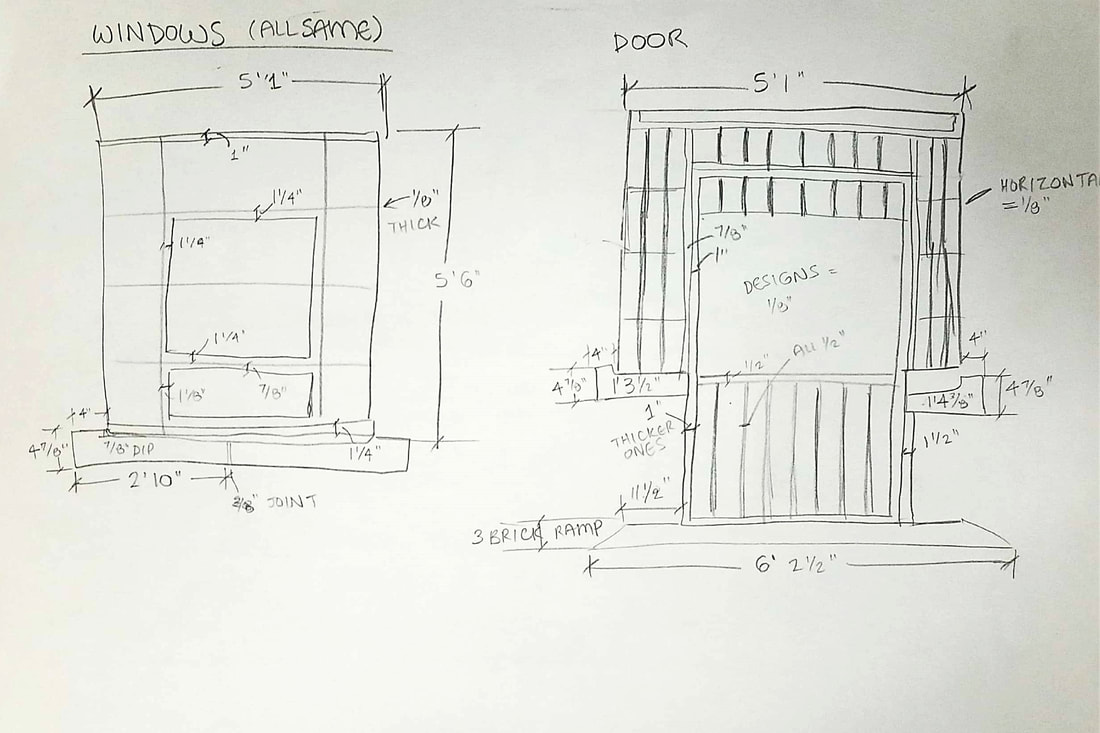  |  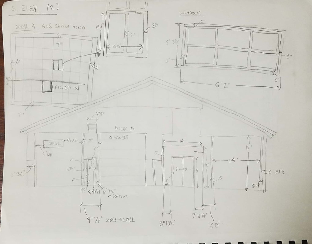 |
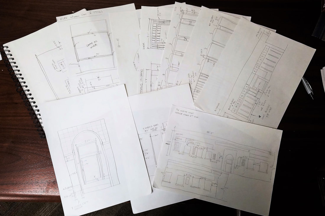
This is just the tip of the annotated iceberg.
As of today we have finished measuring the building. I possess half a sketchbook filled with boxy, not-to-scale diagrams of the facades and tiny dimensions squished in between one another. It is legible to me, and that's what matters. This has been a very useful experience with my first job involving drawings in the real architectural profession and I'm excited to make the final product to show for our efforts. Digital drawings to follow.
Amy Hostetter
Current student.
World traveler.
Future architect.

Archives
January 2019
December 2018
November 2018
October 2018
August 2018
July 2018
June 2018
May 2018
April 2018
March 2018
February 2018
January 2018
Categories
All
Architecture
Personal
Projects
Travel
Work
 RSS Feed
